Menu

Survey & GIS Services - Mapping Data. Defining Land. Empowering Development.

To present PNG-CDCS’s Surveying and Geographical Information System (GIS) services as critical tools in land development, construction, planning, and conflict resolution—designed to attract government clients, landowners, NGOs, and infrastructure project partners.
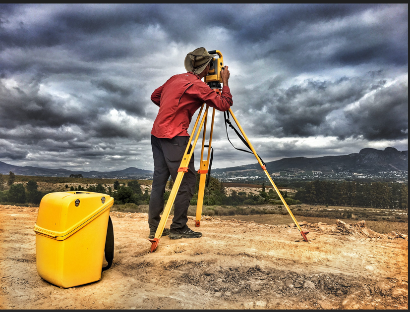
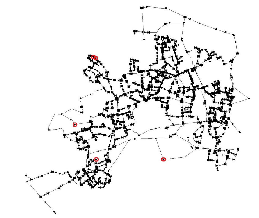
At PNG-CDCS, we offer professional land surveying and GIS services that support everything from construction projects to land use planning and environmental management.Our team of licensed surveyors and GIS consultants uses modern equipment and software to deliver accurate, real-time data and mapping services. Whether you’re resolving land boundaries, planning infrastructure, or managing resources, our solutions help you do it better, faster, and with confidence

Our Survey & GIS Services

📐 Land Surveying

  • Boundary marking and land redefinition (urban and rural)
  • Topographic and cadastral surveys
  • Plot subdivision and consolidation
  • Title deed updates and survey plan preparation
  • Property valuation assistance and legal boundary
    dispute resolution

🗺️ GIS Mapping & Spatial Analysis

  • Mapping and data collection for construction,
    road sand development sites
  • Site suitability analysis for infrastructure projects
  • Land cover/land use mapping
  • Digital map production (2D/3D)
  • Remote sensing and satellite imagery analysis (if applicable)

🛠️ Technical Integration

  • GIS-based decision-making tools for planners and engineers
  • Integration of GIS with civil engineering projects
  • Custom map layers for agriculture, forestry, and utilities

📊 Training & Capacity Building

  • Basic to intermediate GIS software training (QGIS, ArcGIS)
  • Field data collection training using GPS & mobile tools
  • Support for government and local land boards in spatial
    data management

Tools & Technology We Use

  • Handheld and drone-based GPS
  • Total stations and digital theodolites
  • QGIS, ArcGIS, AutoCAD Civil 3D
  • Open-source data platforms and cloud-based mapping (if available)
  • Data loggers and mobile mapping tools

Sample Projects & Applications

No Projects Have Been Carried out Yet!

Why PNC - CDCS For Survey & GIS

  • 📍 Local Expertise – Deep understanding of land tenure systems and customary boundaries in PNG
  • 📏 Technical Accuracy – Modern tools and trained professionals for precise outputs
  • 🧭 End-to-End Support – From field data collection to map presentation and legal documentation
  • 🗣️ Community-Sensitive Methods – Inclusive engagement with landowners and local stakeholders

Testimonials

“The PNG-CDCS GIS team helped us resolve a 15-year land dispute. Their maps and technical reports were accepted by both clans and the district court.”
Community Leader, Gumine
“For our infrastructure planning, we don’t go anywhere without PNG-CDCS mapping first.”
Project Engineer, Public Works Division

Need Survey or GIS Services for Your Project?

Let PNG-CDCS help you plan, build, and manage with precision. Contact our GIS and surveying team today.
Scroll to Top